I lost another exceptional mentor and friend in May of this year - he was a Past AIA President and my Installing Officer at my AIA Presidency Inaugural. Lyman Ennis passed away and was eulogized by his architect friends: "His loss will be felt and mourned by many that knew him, and were fortunate enough to call him friend. Lyman's approach to life, and to architecture, the profession he loved, was passionate, consistent and uncompromising. As was his dedication to his family, colleagues and friends. Always generous with his time in sharing knowledge and ideas, he was a committed force for positive growth and change. Gentle in spirit, tenacious in principle and gracious in his sharing with others, Lyman will be deeply missed."
He was a graduate of USC's program that produced many locally known architects in the Pasadena area." Probably one of the most important and concentrated areas of residential architecture of the City’s Recent Past is located in one such hilly area in southwest Pasadena, known as Poppy Peak, the peak after which the neighborhood is named. It is particularly notable because it contains both an excellent range of different approaches to Modernism as well as excellent examples in themselves of prewar and postwar custom designed houses by both well-known, international figures in Modernism, such as Richard Neutra and Harwell Hamilton Harris, as well as highly competent, but not well-known local practitioners of Modernism such as the aforementioned Cox, whose 1937 house shows an adept attention to a particular site, a feature of Modernist design but yet rendered in clearly individual and independent approach to Modernism. There are also examples on Poppy Peak of later mid-century work, including four houses by the internationally known Case Study House architects Buff, Straub and Hensman, and fine examples of the period by Lyman Ennis (USC), Leland Eivson (USC; who moved and altered a Harris house in 1951), Kenneth Nishimoto (USC), Alexander Pyper, James Pulliam, and William Henry Taylor. All of these later architects were active in the Pasadena/San Gabriel and Los Angeles chapters of the A.I.A. Neutra’s 1955 house here for Dr. Constance Perkins, an art history professor at Occidental College, became the City’s first Historic Treasure (now called a Historic Monument)"
Among his innovations are applied patents for a mechanical modular storage and retrieval system for autos, and a windmill prototype that still remains under development.
Lyman also wrote extensively about progressive social issues, and was deeply concerned about the form of urban development. He published a 3-part series in the local AIA newsletter that made the argument for Land Value taxation in order to productively use urban land instead of land-banking it in surface parking lots. (Part 1, Part 2, Part 3 are posted here) They are based upon the concept of ethical and effective use of urban land. Further discussion of this concept is posted here, and explains the legal ramifications of this approach.
For this reason, I got Lyman and a few of our other architects involved in a "Mobilization of the Human Family" symposium set up by John Cobb in early 2001 for a discussion of this form of taxation. The intent was to create a white paper for a system of taxes that would balance the needs of the common good with a fair tax system, and new taxes on pollution and depletion of resources. This was triggered by the regressive taxation policies of the Bush administration that began to grow the divide between the wealthy and the middle class. Discussion of this issue was moving apace, until the land value tax existing in Pittsburgh at that time was repealed in the spring. John has since moved on with larger visions of a theology of ecology and the writings of Alfred North Whitehead and Charles Hartshorne. His many books, articles and symposiums framing "new economics" have also been included in the series, "An Introduction to Ecological Economics".
As we approach the limits of water, energy and planetary resources, our built environment will necessarily have to encompass not just the traditional zoning and transportation issues, but will also have to consider the impact that human settlements have on the earth and balance its energies and resources, such as water and materials. The form of the city will need to follow the land and use its natural processes rather than obliterate it. This will involve a highly integrated mapping approach that understands the impact of construction and transit on the land itself, through the interplay of natural forces, water supply, energy supply, adjacencies to transit and supply centers, the issues of sewage and stormwater, sun, winds and rain. There is no longer any isolation of sites from each other and these systems will form structures that respond to each other and integrate with the site's natural character.
In order to create or rebuild the appropriate city forms, there will need to be tremendous amounts of information made available, not just systems of regulation that assume standard conditions. Current planning is making use of Geographic Information Systems which are complex computer models that contain all the information on a site or region, reflecting the natural contours, site orientation, geology and water flows."GIS technology, as an expansion of cartographic science, has enhanced the efficiency and analytic power of traditional mapping. Now, as the scientific community recognizes the environmental consequences of human activity, GIS technology is becoming an essential tool in the effort to understand the process of global change." The way that the city is engineered will need to become very responsive to its particular environment, and minimize the energy, water and waste production that occurs. This tends to dictate "hub" systems, or "distributed power" formations, which means that energy is produced locally and water is recycled locally, a far more efficient way of building that mimics natural systems, while consuming far less.
The way to control the development of urban form to benefit humans and nature is through the use and taxation of property, which determines how much development can be placed in a given area. The formulas for these zones should be tied to a value assigned such that It encourages the most appropriate use and form. One form of this is land value taxation, which taxes the land's underlying value rather than the improvements on the land. Higher values encourage more structure in order to derive profit from more square footage, and lower values relieve the pressures of development in areas that require more open space and landscaping in order to maintain natural systems. This system is percieved as more fair than a patchwork of land use codes, and has been in use in cities in Pennsylvania, particularly Harrisburg. Connecticut has just passed LVT legislation.
A different experiment in zoning, as found in Houston, has shown that policies such as street and block sizes also have a major impact on the appropriate form of the city even as it is unregulated with use zones. The pendulum will need to swing back to human scale, not automobile scale.
If the information about the land is available to developers and designers, and is aligned with codes and policies which are in synch with each other, then effective urban and suburban design can be achieved, and balanced with natural landscape and watersheds that are crucial to sustainable existence. The form of the city can then be planned to mitigate the effects of the built up core with greater areas of land that are functioning natural systems in the immediate region. Energy use can thus go way down if the systems, form and function of a city are in synchronization with the naturally-occurring resources.
Thus, "Design With Nature" becomes not just an arcane mapping study tool, but a practical reality that can be modeled and anticipated. This can be used in an intelligent way to restore damaged land and watersheds and bring the built form back into balance with the environment.
Along with local food comes local bees. Need that pollination! Didn't know that bees weren't native to the US, and now their numbers are way down due to a couple of mites. They go along with Farmers' Markets and Birkenstocks up in the Bay area. They're even at the White House now. Can't stop a trend like that!
Our trend is behind the Canadians however. Environment Canada has a page on protecting bees and providing a more biodiverse environment in the suburbs and the city, since their regs allow beekeeping in suburbs and cities.
This is maybe a rah-rah Husky thing for me, but CG/LA Infrastructure, LLC, confirms the Alaska Way Viaduct in Seattle, WA as one of the Top Strategic Projects to be presented at the North American Infrastructure Leadership Forum in September of this year in Washington, DC. It's a key shovel-ready project that will transform the waterfront and reconnect the downtown to the water's edge. It's been years in the making, and much thrashing about over alternatives (tunnel vs rebuild) and costs. The Mayor announced in January that the final decision is a deep-bored tunnel, which ultimately cost him his job. The hearings conducted in Washington, DC for the National Surface Transportation and Revenue Study Commission provided the cost analyses and alternatives in 2006. There's also a simulation of an earthquake event that's the basis for all of this, a possible collapse of the viaduct itself. This has led to a local fight about the tunnel option going forward.
This concept replaces a gritty old double-decker freeway that severs the city from the waterfront and the views of Puget Sound. Seattle Grunge started here, and the Pike Place Market is an integral part of that trench-coat-and-a-bad-hair-day tradition that goes with the rain, the grit and Starbucks coffee shops on every corner. They're concerned about the loss of character because of the reconfiguration, but apparently that's been resolved.
Below is a truly cool animation video of the entire project as it is planned to go forward!
As the California drought pushes water issues front and center, more communities find themselves not only objecting to the methodology of water rate increases and rationing (which are understandably needed when reservoirs are down by an average of 50%), but also the actions and policies of the Metropolitan Water District itself. As farmlands and urban areas go without - due to growth pressures as well - the MWD is continuing its practice of constructing large administrative facilities for its use in sensitive wetlands areas. It's not just the questionable use, but the funding expenditure; an article about the Whittier Narrows project lays it out. The Friends of Whittier Narrows explains the issues with this facility, which is located in a County park.
This, unfortunately, is not atypical of the agency, which is actually a consortium of construction firms which builds and maintains the water infrastructure: Diamond Valley Lake and other reservoirs, California Water Project and the Colorado River Aqueduct. The idea of encroaching on habitat or placing facilites out in the middle of nowhere is not unusual for the MWD, as I've pointed out before. Using LEED as a "Good Housekeeping Seal of Approval" is the latest method of getting structures put up, ostensibly for public education.
It's time to rein in the greenwashing and use the funds to actually preserve natural lands and keep water in the environment instead of creating more paper water for sale to developers. (See the Water Issues sidebar)
Much discussion these days on how to accommodate people and their cars and "stuff" without obliterating the planet. What is readily apparent is that things can't continue in "business as usual" mode, the limits of our resources have already been exceeded. All of our social and planning models are predicated on continuing expansion and growth instead of better efficiencies and more creative use of resources. So we need to change the form of the city. An idea that's been around for decades out in the Arizona mesa is Arcosanti, the beginnings of an Arcology that is predicated on human settlements developed with passive energy and the use of form to modulate an environment for living within urban densities yet integrating the natural processes. The idea of "miniaturization" is integral to its concept.
In 1978 I participated in a summer workshop at Arcosanti, the East Crescent construction, in conjunction with earlier college class studies and for college credit at SLO. Got my hands dirty and my head "stretched"! Paolo Soleri was a former intern with Frank Lloyd Wright at Taliesen West, but didn't last long there (clash of the Titans) and established his own shop at Cosanti Foundation in Scottsdale before starting up the big project out on the desert mesa. He's Italian, and by virtue of his early exposure to Catholicism and the theology of Teilhard de Chardin, he developed a unique, if convoluted, approach to the way humans should live on the earth. The ideas follow the "Omega Point" phenomenology of this Jesuit priest, which essentially argues that mankind is co-creating its own spiritual development to an ultimate point of existence that many religions define as "God". This leads into some heavy conceptualizations about creating that spiritual space, the "noosphere", that facilitates this transformation with close proximity and high interaction. Soleri's argument is that it's necessary for humans to live in a densely interconnected way in order to move towards this "Omega Point". This was before the internet and Twitter.So this approach is grounded in a spritual-network approach as well as an environmental one, that ends up with a radically different way of changing the form of human habitation. Its form is probably too dense and collaborative for our culture, but it lends itself as a good model for dense urban areas that require a regenerative approach to make these areas viable environmentally and socially. It is a precursor to "multi-use" zoning and transit oriented developments that are evolving models in urban planning today, affecting the legal, accounting and finance sectors of our business practices as our cities shift towards this model. As developments become more complex and dense, the project delivery system is also shifting towards an integration of building practices, known as partnering.
Soleri discusses his philosophies developed over the decades on the Arcosanti website, and also provides examples of the development of many Arcologies and other environmental projects, some of which have come to fruition. Fertile ground for some necessary thinking about our urban spaces and how we live.
According to an LA Times article today, the Inland Empire has been developing a strategy for water supplies that work with natural system structures and re-use urban runoff, in order to avoid importing water. This is a strategy that can be implemented in many ways, including urban reforestation and greywater use, as I posted earlier, into a comprehensive system that mimics natural cycles instead of fighting them.
As you can see from the graphic above, however, there is a tradeoff that must be acknowledged, and that is the energy required to run this system for treatment and desalinization. This applies whether it's locally generated power from a "smart grid" or imported power from coal, natural gas, geothermal or even nuclear power sources. The issue withpower generation from nuclear, in particular, is that it uses tremendous amounts of water. In France, for example, at peak use times on hot summer days, the reactors are shut down because they discharge hot water into the aquifers and rivers that are destructive to the environment.
Energy and resources are an inter-tied, "systems" problem. As in E = MC (squared). Not just for rocket scientists!
The MWD sponsored a "Community Leader's Briefing" with Mike Feuer, Assembly Member, 42nd District, in North Hollywood last Friday. The MWD set out this tea party just as the Doormouse legislature was preparing for its final budget vote in Sacramento on Sunday, and Feuer was ably briefing the golden haired girls at the table with his offer of AB 49 butter.
AB 49, sponsored by Feuer, promotes increased water use efficiency by requiring a 20 percent reduction in per capita urban water use and implementation of efficient water management practices/plans by agricultural water suppliers. This is due to the long-term impact of climate change and the critical need for water management. It is based on the repeated mantra of "The future will be shaped by continued phenomenal growth", which is based upon a 1997 Census Bureau population projection.
A panel of MWD representatives and Water Board members were there to present the story of water allocation cutbacks that are affecting the big sectors of agriculture, industry and residents. The Sacramento Bay Delta has fallen into serious disrepair and its ecosytem is faltering, along with the fishing industry (fishkills in watersheds and rivers due to lack of water and high temperatures), which are under Federal protection. Agriculture is faltering as land is taken out of production due to lack of water for high-use crops that produce less and less revenue for the State. The urban and industrial footprint has been rapidly expanded under State policies, even as water demand in the last 10 years has been stablized with conservation as the population grew by over a million.
Then Alice speaks up: How can we keep building more and more housing and developments when there's not enough water now?
And the March Hare answered:We must grow! And grow!
And another Alice asks:Can we capture from runoff basins? What about conserving in commercial allocations and integrating water planning? The Hatter replies: We are out of time now.
Outside this tea party, the civic and regional leadership are having a Local Government Summit in Sacramento to take back local control and sponsor a Constitutional Convention for reform of the State fiscal structure and accountability to the voters, called "Rebuild California from the Ground Up". This is covening at the same time as the State Legislature is expected to vote on a final budget today, perhaps an incentive for the Doormouse.
UPDATE: This convention, sponsored by the League of California Cities, has resulted in consensus on reform initiatives to be put before the voters, with some discussion on whether a complete restructuring of State governance is needed.
In all seriousness, information at the United Nations site lays out a model for the holistic planning approach that must include the citizens and voters, and look at the human capital in context with the environment. California is a fundamentally progressive state, and could be a leader in solving problems by restructuring the process to break out of the old political structures that are hindering its ability to produce a sustainable model for human habitation in a viable environment.
At the beginning of this year it was noted by CG/LA that infrastructure spending will account for 2.9% of world GDP, primarily in developed countries as part of their stimulus plan in response to the global recession. This has major implications in two areas: the way that these projects are developed and financed, and the way that "intelligent infrastructure" reduces the impact of energy use per capita and unsnarls traffic to cut pollution and emissions.
To quote: "(CG/LA) also predicts that, due to the global financial crisis, the US will begin to transition toward a more Spanish-style infrastructure financing model. In Spain, large engineering and construction firms with significant balance sheets, such as ACS and Ferrovial, originate, build, operate and take equity stakes in national infrastructure projects".
"The existing infrastructure financing model in the US involves governments selling bonds to hire infrastructure developers that provide construction services but do not take equity in or operate the projects they help bring to fruition. This model, which (CG/LA) estimates to be sixty years old, is nearing extinction as financial players will increasingly join forces with large engineering and construction firms to create a more Spanish-style way of delivering infrastructure".
This new model is a private-sector at risk model, rather than traditional US public municipal bond issue financing, which has come into use in Europe with its more socialistic governance structures. The whole deliverables process under this model has just mutated...partnering has to be implemented in the structure of these projects. Partnering is a method whereby risk is shared by all parties -including the owner and the financing - and this is factored into the project budget. This model is also not currently legal in the State of California, and is problematic in the United States due to traditional design-bid-build structure that has evolved in this country which separates funding and ownership from even the more recent design-build process. So there's an uphill battle to put this kind of project delivery in place, and raises the issue of who owns the infrastructure for the public good. This impacts city/state/county funding models which have traditionally consisted of Dept. of Water and Power management and revenue generation at the local level. Now the infrastructure profits would flow to private entities that do not necessarily have transparency requirements or accountability to the public, but rather a duty to shareholders in those companies.
Some of the larger design and construction companies in the United States have evolved towards this model for infrastructure projectsParsons (private), Fluor (public), Jacobs (public) and Sverdrup (private). This is due to the expansion of their businesses into Europe over the last 70 years, in addition to their traditional base of US Government infrastructure work.
The critical need for upgraded infrastructure in "smart grid" configuration (distributed power, for example) is driving this new kind of model which creates the efficiencies needed to conserve and manage energy, water and transportation systems on the large scale now required by cities and regions. But can "the commons" be preserved under this model? If everything goes towards private profit with no public accountability, what happens to the captured resources of wind, rain and sun? We all know what has happened to the land - once it's in private hands it no longer provides its natural functions. This has led to the environmental degradation that the evolving private-sector infrastructure model is supposedly mitigating.
There is therefore a requirement for a Natural Capital balance sheet which includes environmental and social capital as costs and benefits. It will need to account for a human population limit that can be sustained by the natural world and its diverse spiecies. It is a model of stewardship, a driver of "miniaturization" of human consumption and impact.
Otherwise the entire model moves the global balance into utter destruction of the natural processes that give us all life.
Langendorf Bread? "Extra energy for you too". Back then the bleached flour was the thing to do before steroids became popular. Flavor was not an issue. I fondly remember that marketing jingle, it was a bakery that supplied bread all up and down the west coast in the postwar go-go decades.
Speaking of growth, California has grown to the world's eighth largest economy by expansionist policies built into its very economic and political fiber, which translates into a powerhouse punch in Washington (our pumped-up Governator - Langendorf, right? - being the latest to ride this beast). Every policy was predicated on population growth to feed profits across entire industries, particularly development and consumer products. There was no end in sight to the polices that encouraged the boom. Except the end has been here for over four years now, while housing and development policies continue to push product, and port development expands to feed the consumer supply chain.
The Los Angeles Times has documented the probable political impact of the outmigration from California in the last four years, a House seat. In order for California to influence public policy and obtain Federal dollars, it has consistently grown its business and development base, which brings in the bodies to justify the policies. The article refers to PPIC, a research institute that provides information and recommendations to governments and regional bodies throughout California.
The Public Policy Institute of California provides research, position papers and surveys in order to substantiate public policy positions in California. Its sponsors are a mix of developers, builders, land use orgs, the MTA, private foundations, universities and utility companies.It's a technically nonpartisan group, but the research is always pointed towards substantiating policies that push development.
It's sort of a chicken-and-egg problem, since forcing growth through development (jobs and housing) attracts population, which feeds the whole cycle no matter where you start. This leads to the inevitable exhaustion of resources and space, which then finally triggers a collapse, as we've seen, in housing and soon to be in commercial development because of the "bubbles" this process creates due to the profits it generates for the developers and industry. This kind of explosive growth now has a serious downside for the entire global economy, since bubbles destabilize what should be an orderly process of development with its checks and balances, producing horrific negative impacts in the near future through a global banking system that leveraged hot air (ground zero of overvaluation is California) for profit.
The Federal bailouts (whoops, did WE do THAT?) resulting from these bubbles have hit historic proportions, per the RGE Monitor, and will leave a legacy of debt for generations that will come due at the same time that the environmental collapse hits. The serious consequences of leaving out human capital and environmental capital in narrow analytics and short-sighted policies are now quite evident, and so our models will now necessarily shift to Natural Capital models that the rest of the world is fighting to establish (see sidebar: Web of Green).
Thomas Friedman points out that those who bear these bailout costs are the public, while a few individuals are enriched. Guilded Age at its finest, human nature at its worst. Connect the dots: Goldman Sachs made $3.44 billion in profit this past quarter, while the U.S deficit topped $1 trillion for the first time in the nation's history and appeared to be headed toward doubling that figure before the budget year is out. Since most of the increase in the federal deficit is due to bailing out the banks and salvaging the greater economy they helped destroy, why is the top investment bank doing so well? Paul Krugman also points out the consequences of propping up entities like Goldman Sachs.
Now it's goats. Better than a weedwhacker and no gasoline. Conveniently provides fertilizer and cheaper for the CRA to hire than people. Bunker Hill gets a weed trim curtesy some livestock. Here's the story at Curbed LA.
It seems LA is putting together a hell of a food chain here. Using actual, real food sources. The LA Farmer's Market at 3rd Street downtown is celebrating its 75th as a destination, and this trend towards local sources definitely has potential. Goat cheese stuffed chicken with wild mushrooms, anyone?
It's come to this. The Local Food movement (those Farmers Markets!) gives way to mini-agriculture and gentlemen farmers. If it weren't for the current zoning laws restricting fowl of all kinds, we'd be seeing chickens, geese, and other domesticated types repopulating the suburbs. A local example is here. Many people are promoting the old suburban and semi-rural practice of domesticated fowl as local food supply, which also keeps garden pests at bay (note: snails and cockroaches!).
There's an organization that promotes this movement, however I fail to find anything about the specifics of wringing the thing's neck or plucking it for dinner. WHAT do you do with the feathers? Pillows use goosedown...
One from Newsweek. And the Urban Chicken A local ordinance video is here on the WSJ channel. Helpful McNuggets of advice are all over the net: "If you are hatching your own chickens, about half of them will be roosters. They can't be kept together because they'll kill each other and harm the hens as well. Likewise, if your main reason for keeping chickens is for the eggs, remember that chickens can live 8-10 years but only have a productive life (one egg every 1.5 days) of about 2-3 years. It's not easy to find homes for roosters and unproductive chickens, and usually your only option is to sell them for meat. However, keeping older chickens is often an option. They don't eat quite as much, but still produce delicious eggs. The roosters make good chicken jerky if you're ambitious. Be aware that rooster meat is pretty tough and would rarely make something like fried chicken taste good."
One thing this all leaves out are those famous peacocks roaming Arcadia and various other parts of LA, Pasadena, Glendora and Palos Verdes that drive the residents to nefarious criminal activities to be rid them, or even thrash it out in local Planning Commission meetings. When the birds screech, it sounds like a cat being strangled, can't say I blame them. That's what feral cats are for, I suppose. Or perhaps a nice roast?
I can't resist posting excellent design solutions that address regenerative solutions to "throw-away" public space in formerly industrial areas in river waterfronts! From Architectural Record (with a gorgeous slide show):
"Travelers visiting Quebec City this summer who haven’t been there for some time, and who approach by car along the Saint Lawrence from the West, will find a stretch of the river’s waterfront completely transformed. Just past the Pont de Québec and the Pont Pierre-Laporte, what had once been a largely industrial landscape dotted with petroleum storage tanks is now a leafy linear park filled with pedestrians, runners, and cyclists. This 1.5-mile-long, $63 million (U.S.) section of the Promenade Samuel-de Champlain is part of a vision for a continuous emerald swath that will eventually extend another 6 miles to an area of shoreline near the fortified walls of the Old City."
River waterfronts around the world have a nearly universal legacy as being the "freeway" of the old industrial age. This project is similar to many across the globe, in reclaiming urban rivers and engaging in them instead of keeping the old model of turning the city's back on it. The LA River is a project in a similar vein, except that it has the added problem of being channeled in concrete by the Army Corps of Engineers and effectively turned into a sewage pipe, threatening its status as a navigable waterway.
The LA County Supervisors have a long history of pushing overdevelopment past available resources, although there have been small victories by organizations such as the Santa Monica Mountains Conservancy. I'm including a snapshot of a summary of the award-winning LAT article as published in the Amicus Journal in 2000. Over-allocation of water was caused by this countywide development push back in 1998, despite public protest, and has resulted in the shortages of water that we are experiencing today. Links to the detailed articles are listed below.
A striking issue with the development model of the last several decades is that it relies on packing the McMansions onto winding deadend streets that are completely auto dependent and isolated from town centers and parks. New Urbanism has tackled this to a certain extent by moving to a more dense model that shortens auto driving by going back to the old town street grid, as well as an integration of uses that mimics the city-center density model with a mixed-use emphasis. This unfortunately tends to force creation of a tremendous amount of structure into a landscape that is already withering under the onslaught of human habitation.
What if a GREEN "Pattern Language" - as was developed by Christopher Alexander for designing human spaces - used a vocabulary of low-impact and regenerative structures and landscape, driven by natural vectors - not just economic ones - to restore overdeveloped areas and return watershed and landscaping to nature? This would be an application of the residential end of the Green Transect development spectrum.
This pattern would begin with the "building block" of homes that use the characteristics of the site and its orientation to the sun and wind. This creates lots that are driven by the east-west axis placement and orientation to the south sun that can be tempered with trees and overhangs. This also creates more opportunity to use trees and natural landscaping to absorb the rain that falls onto the area. We begin to build this pattern into a "play street' that is designated as residential access only with trees and landscaping instead of driveways: Then we begin to cluster these patterns around a car and utility access system that also provides private play areas for the adjacent homes. This is far more efficient than the old utility distribution, and supports the creation of "distributed utilities" in a hub system, facilitating the development of "smart grid" technologies and reducing the expense and cost of providing utility connections. The mail chests would be located here, as well, for efficient delivery/pickup. If renovated and infill suburban tracts were rebuilt on this more efficient model, then the ability to supply grey water from local mini-treatment facilities to a landscape irrigation system becomes completely feasible. The urban area becomes a means of supplying water to the aquifer which has already been imported by human consumption (to be delicate about it). This reflects the "soft path" model of infrastructure integration referred to in my earlier post. Ultimately, this model for the neighborhood can link together as a tight grid with alternating traffic streets and play streets, with the homes oriented so as to use the natural topography and solar orientation in a passive system that reduces the impact of development. Added to this are the grid and utility efficiencies, and the limitation of auto traffic to the streets that access the motor courts. The "play streets" are identified and accessed through a restricted auto entry that uses mature specimen trees to define these streets. What becomes immediately apparent is the ability of the residents to walk or bike through the neighborhood access ways without confronting auto traffic except every other block. This "through way" access (paved with DG) replaces traditional sidewalks along the streets, which are no longer needed. The entire neighborhood ultimately becomes a means of using the urban tree canopy - and keeping it watered - that offsets the dense urban centers creating the "urban heat island" effect. This is the same sort of exercise that was used in San Francisco to generate the urban forms and use patterns for the Treasure Island redevelopment, as I posted earlier.
As I pointed out in a previous post, there is tremendous pressure from LA/San Pedro, Sacramento and economic policy folk in Washington to keep the growth model moving ahead full steam in California. The trouble is, this growth model is unsustainable, which is why the residents of the state are resisting the growth pressures that have degraded the quality of life in what was formerly bucolic Southern California.
It's reflected in water shortages, power outages, rapidly increasing utility bills, gasoline price increases and clogged freeways. The resources have been maxed out for over a decade, as the USC study "Sprawl Hits the Wall" has documented in intensive data analysis, and we are currently in an unsustainable situation with more growth being mandated by SCAG, the coalition devoted to more development at all costs. They have pushed bills through the legislature that require more development (RHNA allocations and SB 375 that force communities accept more people and traffic), and have circumvented legislation requiring that adequate supplies of water be available for this development.
While the shift in human habitation in California from sprawl to a coherent urban form is welcome, the infrastructure is not available to support it. It helps to look at population areas, road transit infrastructure and what's called "inter modal transportation", which is what the shipping network from the port is all about. We have a conflict between residential needs, the regional resources and the increasing use of the highways for shipping purposes. To put it in perspective, I've shown a snapshot (click to enlarge) based upon an entire interactive map at wikimapia which displays the whole system of rail and highway infrastructure in California. My snapshot shows the 710 "gap" which has long been shut down by South Pasadena using CEQA in defense of its existence. The pressure for this connector comes from the shipping industry, which has outgrown the rail infrastructure during the mergers and acquisitions of the old rail lines. In this snapshot, the grey rail lines for the Alemeda Corridor for shipping from San Pedro appears at the bottom where it bends east in the appropriately-named City of Commerce, heading out to the main rail shipping lines across the country.
To quote from a comment on Kunstler's site: "US railroading is accomplished on two tiers: Trunkline Mains, result of mergers over the last fifty years; and the 100's of viable feeder lines salvaged or spun-off from the merged mega railways. Kunstler's book, "The Long Emergency" helps frame the picture that fosters attention to deliberate rehab of branchline rail connection to many places now truck-dependent. Places near dormant rr corridor not of interest to operating shortline operators will need to approach operators, and form local consortiums or partnerships to reconnect."
This is a call to rebuild shipping rail rather than increasing truck traffic on the overused highways. Rail is a far more efficient transport from a sustainability point of view, since it uses rails set in gravel instead of immense concrete structures, and can be grade-separated or put underground without huge emissions due to the improved electric engines in use these days. It's time to do the smart thing by using rail as the main shipping backbone instead of using the 210 freeway to Sylmar and Burbank airport as truck shipping overflow, for example, which would free up the freeway for residential transit and avoid the costs of ever-widening freeways and increasing auto exhaust. In that case, the "710 connector" is not necessary to provide the regional shipping channel. As you can see from this Transportaton Services site, rail shipping is part of a huge industry that connects all the ports on the west coast with shipping lines across the country, with interconnections to air cargo, freeway truck transit, and ocean cargo shipping. Other mind-numbing statistics are here.
With the revitalization of the appropriate infrastructure, as well as regenerative efforts in the local communities that balance the "black hole" of construction with natural habitat restoration, there is hope that there is a sustainable future for our grandkids.
The plan above is just to show how strategic plantings can reduce the house temperature by at least 10 degrees in the summer. This is an existing house built in 1937, no insulation except for heavy attic insulation recently blown-in to R30, and a light stucco exterior. Pretty typical pre-war construction (you can't get it built like this anymore). Also no shear walls, but that's a different issue.
This is a site plan showing how the trees have been planted over the years to block the summer sun and absorb the solar energy the sun provides. Because the house is relatively heavy construction and air-leaks like a sieve, not much point in trying to make it work like homes built in the last 20 years. It's a heat-of-mass system that works well because it resists warming up due to the deep foundations and large overhangs and porches. Has plenty of windows and fabulous cross-ventilation. Most homes of that era were built this way because there wasn't any air conditioning then, and you had to build homes in a way that used inherent material properties and site characteristics to balance the available light and temperature changes. New "green" concepts, right?
Also note the orientation of the house on the site. The east and north sides of the structure are situated so they have the most exposure. The south and west sides are surrounded by garden area. This is where the trees go.
The trees absorb energy and convert it to oxygen and H20, it's not just simple shade. So catching the sun on the south and west sides of the property are the most effective way to keep the entire structure from heating up as well as create a microclimate that's cool and shady. As a result, there's not much need to run the air conditioning except during those miserable August heat waves. So it's very low impact, which is a good strategy for single family residences, but it also contributes to the urban forest which counteracts the "heat island" effect from all the road paving, dark roofs and concrete work in urban areas.
This shows very clearly in my earlier post with the satellite and shuttle photos. The urban area is mostly gray, and the residential tree canopy immediately abutting the paved-over city is very visible. This is the mitigation that the tree canopy provides against the "urban heat island" that is being created across the landscape by development and contributing to the approximate 10-degree local temperature increase in these areas, as well as the lack of precipitation in urban centers.
With a lot of ideas flying around about how to plant bioswales, cisterns, etc. which work well when integrated into a re plumbing and replanting effort, I thought I'd post one that's almost too easy. This is a glamorous shot of my rear trash yard. What's going on here is that a few years ago, I repaved the driveway all along the side of the house that leads to this area adjacent to the garage. This driveway receives the water from the roof downspouts, rainwater and some garden irrigation over spray, and the flow line of the site drainage goes to this back area. You can see this from the water drainage to the gravel area that the trash barrels sit on.
When redoing this paving, I held back the paved area about three feet from the back wall, and filled the area with gravel, planted seasonal vines on the wall that don't take a lot of water. The nearby tree also appreciates this contribution to its root structure tremendously. I also don't have to worry about large ponds of water back there in the winter.
Such are the little strategies that move our existing homes to the "green" side! It's not necessary to make huge changes, just some smart ones. This gets our clean water back into the ground instead of down into the storm drain channels, which should really only be "severe overflow" drainage structures.
An open turf area. This open space hosts "civitas", the means to foster, mobilize and coordinate civic concern in the community for sustainable public and private spaces. This includes urban planning, public policy, infrastructure, watershed management, zero impact projects and regenerative "green" strategies. These create innovative spaces and design so people can reconnect with nature.
The California Natural Resources Agency just released its fourth Climate Change Assessment, a call to action on rising global temperatures — the state’s first in six years. August 2018, 132 pages covering these issues:
A space program initially launched in response to the Soviet challenge and put forth in a speech by John Kennedy in 1961 resulted in not only technology advances, but a shift in human awareness of the biosphere we all inhabit. This resulted in the Apollo program that put men on the moon and let human eyes look back upon the world.The view of a blue globe floating in empty space marks a transformation in human understanding and points towards an evolutionary change in collective priorities.
Ongoing action via the Planetary Society - Carl Sagan, from his 1994 book Pale Blue Dot: "Look again at that dot. That's here. That's home. That's us." And that Bulgarian folk song from Sagan's Golden Record that NASA sent off into interstellar space in 1977. And that poem by Maya Angelou inspired by Sagan's "mote of matter". Carolyn Porco writes about how this image of our planet came to be.
Apollo 8 astronauts later presented their experiences to the US Congress: "To see the Earth as it truly is, small and blue and beautiful in that eternal silence where it floats, is to see ourselves as riders on the Earth together." Here's a movie of that experience from the astronauts.
Public presentations from JPL/NASA on climate change are available as videos from the Pasadena League of Women Voters as part of their Climate Change Forum series
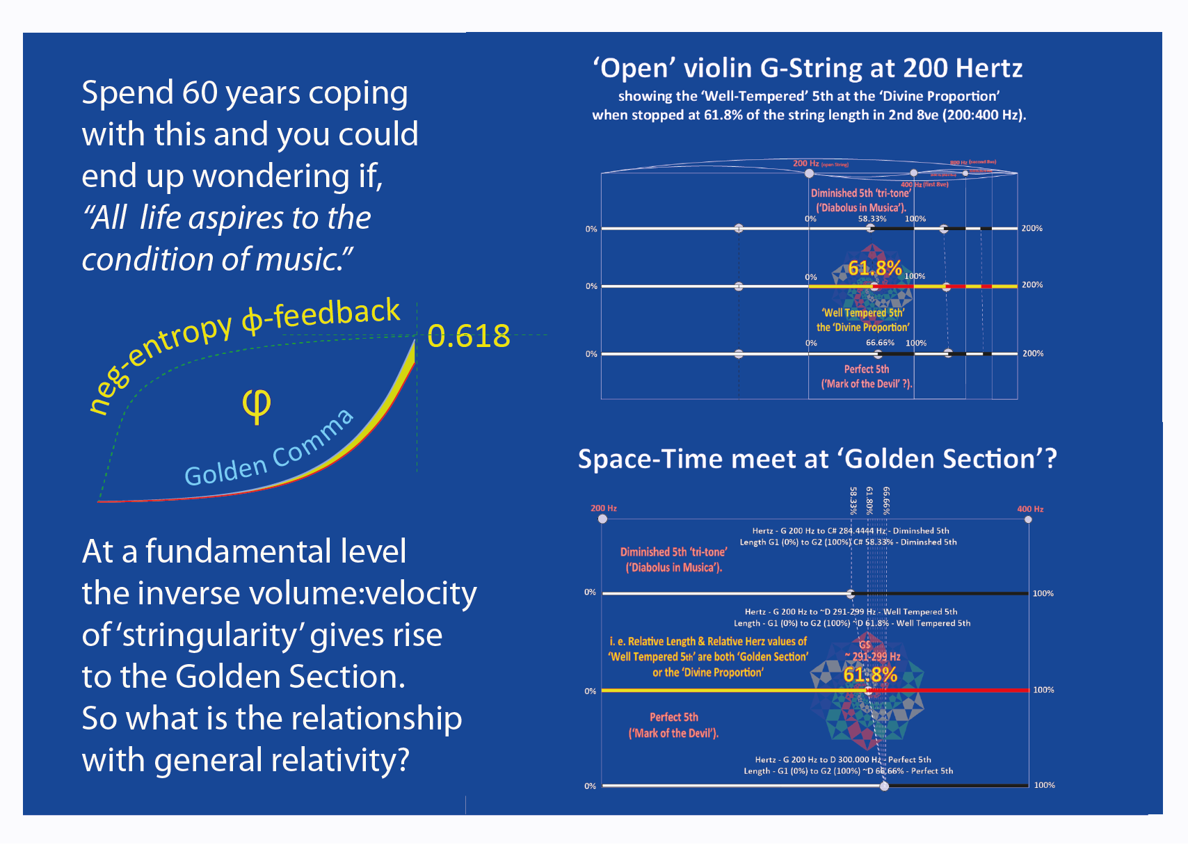
The Fibonacci sequence is a famous group of numbers beginning with 0 and 1 in which each number is the sum of the two before it. It begins 0, 1, 1, 2, 3, 5, 8, 13, 21 and continues infinitely. The pattern hides a powerful secret: If you divide each number in the sequence by its predecessor (except for 1 divided by 0), then as you move toward higher numbers, the result converges on the constant phi, or approximately 1.61803, otherwise known as the golden ratio.
My regenerative concept for the Trade Center was submitted to the New Visions New York panel for consideration as an overarching vision. The documentation is here. The concept of crystalline light shattering at 9:15 am on Sept. 11, in a site regenerated with a tree of life and "green towers" now lives on in many other urban design schemes.

 I lost another exceptional mentor and friend in May of this year - he was a Past AIA President and my Installing Officer at my AIA Presidency Inaugural. Lyman Ennis passed away and was eulogized by his architect friends: "His loss will be felt and mourned by many that knew him, and were fortunate enough to call him friend. Lyman's approach to life, and to architecture, the profession he loved, was passionate, consistent and uncompromising. As was his dedication to his family, colleagues and friends. Always generous with his time in sharing knowledge and ideas, he was a committed force for positive growth and change. Gentle in spirit, tenacious in principle and gracious in his sharing with others, Lyman will be deeply missed."


